


Introduction
In modern navigation technology, inertial systems play a crucial role in guiding aircraft, spacecraft, submarines, and even autonomous vehicles. Among the most widely studied topics in this field are the Advantages and Limitations of Inertial Navigation System. These systems operate independently of external signals, making them highly valuable in environments where GPS or other satellite-based systems are unavailable or unreliable.
This article explores how inertial navigation works, along with a detailed discussion of the Advantages and Limitations of Inertial Navigation Systems, highlighting both their strengths and their technical challenges.
What is an Inertial Navigation System?
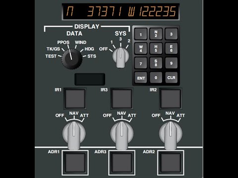
An Inertial Navigation System (INS) is a self-contained navigation method that calculates position, velocity, and orientation using motion sensors such as accelerometers and gyroscopes. Instead of relying on external references like satellites or ground stations, it continuously measures acceleration and angular velocity to estimate movement over time.
Because of this independence, INS is widely used in military applications, aerospace engineering, and deep-sea exploration where external signals are weak or unavailable.
Advantages of Inertial Navigation Systems
The Advantages and Limitations of Inertial Navigation Systems can best be understood by first examining their key strengths.
1. Independence from External Signals
One of the most important advantages is that INS does not rely on GPS or any external communication system. This makes it highly effective in environments such as underwater, underground, or in space where satellite signals cannot reach.
2. High Reliability in Hostile Environments
Inertial systems are resistant to jamming, interference, or signal loss. This makes them especially valuable in military operations where GPS signals may be intentionally disrupted.
3. Real-Time Continuous Data
INS provides continuous navigation data without interruption. Since it does not depend on external updates, it can maintain real-time tracking even during signal outages.
4. Compact and Self-Contained Design
Modern inertial systems are compact and can be integrated into a wide range of platforms, including missiles, drones, aircraft, and autonomous robots.
5. Quick Initialization
Unlike some navigation systems that require long setup times or external calibration, INS can begin operating almost immediately after activation.
These strengths highlight why the Advantages and Limitations of Inertial Navigation Systems make them essential in advanced navigation applications.
Limitations of Inertial Navigation Systems
Despite their usefulness, inertial systems also have several drawbacks that must be considered.
1. Error Accumulation (Drift)
The most significant limitation is drift. Small measurement errors in acceleration or angular velocity accumulate over time, leading to increasingly inaccurate position estimates.
2. High Cost of Precision Sensors
High-accuracy inertial navigation requires extremely precise gyroscopes and accelerometers, which can be expensive to manufacture and maintain.
3. Calibration Requirements
INS devices require careful calibration to maintain accuracy. Even slight misalignments or sensor degradation can significantly affect performance.
4. Lack of Absolute Position Reference
Since INS is self-contained, it does not provide absolute positioning. Without periodic correction from GPS or other systems, errors can grow unchecked.
5. Complex Data Processing
The system relies on continuous integration of motion data, requiring advanced algorithms and computing power to maintain accuracy and stability.
These challenges demonstrate the critical balance involved when evaluating the Advantages and Limitations of Inertial Navigation Systems.
Applications of Inertial Navigation Systems
Inertial navigation is widely used across multiple industries due to its independence and reliability.
- Aerospace: Aircraft and spacecraft navigation
- Military systems: Missile guidance and submarines
- Autonomous vehicles: Self-driving cars and drones
- Marine navigation: Underwater exploration vehicles
Each of these applications benefits differently from the Advantages and Limitations of Inertial Navigation Systems, depending on operational conditions.
How Inertial Systems Are Improved
To overcome limitations, modern navigation systems often combine INS with other technologies.
Integration with GPS
Combining INS with GPS helps correct drift errors while maintaining continuous navigation during signal loss.
Sensor Fusion Techniques
Advanced algorithms merge data from multiple sensors such as magnetometers, cameras, and radar to improve accuracy.
Machine Learning Enhancements
Some modern systems use AI-based models to predict and correct navigation errors more effectively.
Conclusion
The Advantages and Limitations of Inertial Navigation Systems highlight both the power and complexity of this technology. While INS provides independent, real-time navigation in environments where other systems fail, it is also prone to cumulative errors and requires advanced correction methods.
Understanding both sides of the system is essential for engineers, researchers, and industries that rely on precise navigation. As sensor technology and computational methods continue to improve, inertial navigation systems are expected to become even more accurate and reliable in the future.
